
155-D1-3
Displaying 1 - 50 of 52
| Catalog # | Name | Description | ||
|---|---|---|---|---|
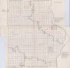
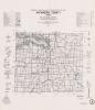
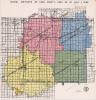
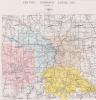
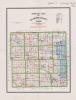
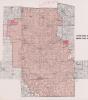
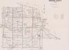
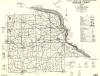
| 1 | RSC-AL-128 | Map | School district map of Allamakee County, Iowa, 1966. Shows school district boundaries and districts to be absorbed by either the Allamakee Community School District or the Eastern Allamakee Community School District. Used in school district consolidation and reorganization. Originally in Allamakee County Box 3 Folder 9. |
 |
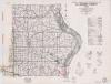
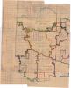
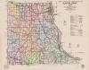
| 2 | RSC-AL-129 | Map | General Highway and Transportation Map for Allamakee County, Iowa, dated 1955. Some school district boundaries added in red ink on the lower part of Allamakee County, related to the Postville school consolidation. Map used in school consolidation and reorganization. Originally in Allamakee County Box 4 Folder 4. |
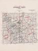
 |
| 3 | RSC-AL-130 | Map | School district plat map for Postville Community School District, in Allamakee County, Iowa. Map states it was approved February 26, 1958. Shows district boundaries and added territory with notes. Used in school district consolidation and reorganization. Originally in Allamakee County Box 4 Folder 7 |
 |
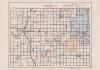
| 4 | RSC-AL-1A | Plat Map | A Plat Map of Allamakee County, showing Allamakee Community School District, Approved March 31, 1958.Interleaved in Pages of RSC-AL-1. |
 |
| 5 | RSC-AL-1B | Plat Map | A Plat Map of Allamakee County, showing Eastern Allamakee Community School District, Approved May 26, 1954. Interleaved in Pages of RSC-AL-1. |
|
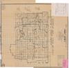
| 6 | RSC-AP-1 | Map | "Official School Map" for Appanoose County, Iowa, dated 1962. Labels school districts and shows their boundaries. Originally in Appanoose County Box 1 Folder 1. |
 |
| 7 | RSC-AP-2 | Map | General Highway and Transportation map for Appanoose County, Iowa, dated 1971. Used in school district consolidation and reorganization. Originally in Appanoose County Box 1 Folder 1. |
 |
| 8 | RSC-BT-186 | Map | School district plat map for Greene Community School District, dated September 4, 1957. Shows the newly voted on school district boundaries. Originally in Butler County Box 3 Folder 38 |
 |
| 9 | RSC-BT-188 | Map | School district plat map for Parkersburg Community School District, dated July 1, 1955. Originally in Butler County Box 4 Folder 5 |
 |
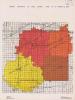
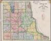
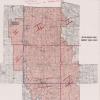
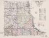
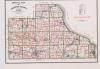
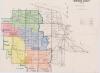
| 10 | RSC-BT-198 | Map | School district map focused on Butler County, though it includes territory surrounding the county. The map shows various school district boundaries, many districts have brief notes on whether they will stay independent or consolidate. Undated, but one note mentions an upcoming consolidation in 1961. Originally in Butler County Box 6 Folder 5 |
 |
| 11 | RSC-CA-1 | Map | School district map of Cass County, Iowa, dated July 1, 1966. Prepared by the Cass County Superintendent of Schools. Labels school districts in the county and shows their boundaries. Includes some surrounding counties when the school districts overlap. Originally in Cass County Box 5 Folder 1 |
 |
| 12 | RSC-CA-2 | Map | School district map for Cass County, Iowa, as of March 10, 1975. Shows school districts and their boundaries. Includes some territory from surrounding counties if the school districts overlap. The map has notes that indicate it was requested by Dale King, Cass County Auditor, and filed April 25, 1979. Originally in Cass County Box 5 Folder 1 |
 |
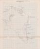
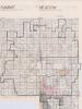
| 13 | RSC-CL-1 | Map | Plat map for Summit Township and Meadow Township in Clay County, Iowa. The map has the boundaries for the Spencer Community School District from 1963 to 1965 added. The map shows how the boundaries of the district changed over the two year period. Originally in Clay County Box 2 Folder 4 |
 |
| 14 | RSC-CS-1 | Map | General Highway and Transportation map for Chickasaw County, Iowa, with school districts added. Undated, but handwritten note on the map states that it was filed with the County Superintendent's office on January 21, 1957. A large section in the southeastern corner of the map, centered on Fredericksburg, is colored blue. |
 |
| 15 | RSC-CS-2 | Map | School district map for Chickasaw County, Iowa, dated 1968. Labels school districts and their boundaries, including a few districts that overlap into Chickasaw County. |
 |
| 16 | RSC-CS-3 | Map | School district map of Chickasaw County, Iowa, undated. The map labels school districts in the county and their boundaries, with a few handwritten notes. Undated, but one note mentions in the past tense a transfer of territory between school districts in May 1966. |
 |
| 17 | RSC-CY-1A | Map | A 1958 map of Clayton County. Has the area's school districts labelled and their boundaries outlined in red ink. Pencil markings in Mendon, Giard, and Clayton Townships indicate a change in school district boundaries. |
 |
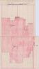
| 18 | RSC-CY-1B | Map | A close up plat map, mostly blank, of a small section of northeastern Clayton County, Iowa. Shows land to be taken from Giard Township School District and given to M.F.L. School District and to Marquette-MacGregor School District in school consoldiation. Undated, but post-1960 due to mention of M.F.L., which was formed that year. |
 |
| 19 | RSC-CY-1C | Map | A close up plat map, mostly blank, of a small section of northeastern Clayton County, Iowa. Shows land to be taken from Oakland Independent School District and given to Garnavillo Community School District. Undated, but likely from post-1960 based on associated materials. |
 |
| 20 | RSC-CY-2B | Map | School district plat map for a proposed Central Community School District, centered on Elkader, Iowa. Undated, but in context of other materials in the original folder, likely from 1953-1961. Originally in Clayton County Box 1 Folder 1 |
 |
| 21 | RSC-CY-2C | Map | Map labelled "Central Community School District, Elkader, IA," undated. A map focused on Elkader, Iowa, with four different sections colored different colors. includes some information on who lived in specific houses in area. Undated, but in context of original folder likely from 1953-1961. Originally in Clayton County Box 1 Folder 1 |
 |
| 22 | RSC-CY-3 | Map | "Official Map of Clayton County, Iowa," dated 1950. Map has been modified to school school district boundaries, though it does not label them. A handwritten note on the map specifies that it is an official map of the Central Consolidated School District, dated September 1953. Originally in Clayton County Box 1 |
 |
| 23 | RSC-CY-4A | Map | Section of a school district plat map for a proposed consolidation of Central Community School District and Volga Consolidated School District, dated 1960. The map labels townships and has the location of 'Director Districts' within the proposed plan. Originally in Clayton County Box 1 |
 |
| 24 | RSC-CY-4b | Map | Section of a school district plat map for a proposed consolidation of Central Community School District and Volga Consolidated School District, dated 1960. This is a three township section of a school district plat map. Originally in Clayton County Box 1 |
|
| 25 | RSC-CY-5 | Map | "Official Map of Clayton County, Iowa," dated 1950. The map has the handwritten addition of one school district's boundaries outlined, with proposed additions included. The district is unlabelled, but is likely the Central Consolidated School District centered on Elkader, Iowa. The school district boundaries are undated, but likely around the early 1950s, based on comparison to RSC-CY-3. Originally in Clayton County Box 1 |
 |
| 26 | RSC-CY-6 | Map | "General Highway and Transportation Map, Clayton County, Iowa," dated 1953. Shows school district boundaries, but does not label the districts. The roads within the boundaries are emphasized using deeper colored pencil shading. Originally in Clayton County Box 1 |
 |
| 27 | RSC-CY-7 | Map | Official school district plat map for Volga Independent Consolidated School District, dated January 26, 1953. Focuses on Sperry and Highland Townships in Clayton County, Iowa. Originally in Clayton County Box 1 |
 |
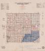
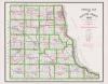
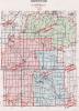
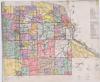
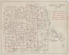
| 28 | RSC-DE-49 | Map | Delaware County, Iowa map of school districts, 1974. School districts are labeled and shaded in various colors. |
 |
| 29 | RSC-DU-100 | Map | Westerm Dubuque County Community School District, County Board Election Areas For Western Dubuque |
 |
| 30 | RSC-DU-101 | Map | Official Map of Delaware County, Iowa. Exhibit C of Dubuque County Plan. A Map of Delaware County used in the reorganization and consolidation of Schools in Dubuque County. |
 |
| 31 | RSC-DU-102 | Map | General Highway and Transportation Map Clayton County, Iowa. Hand drawn and labeled on the map are the school districts. Used in the reorganization and consolidation of Dubuque County. |
 |
| 32 | RSC-DU-103 | Map | A Map of Jackson County on which the Schools have been circled in ink. Used in the reorganization and consolidation of schools in Dubuque County. |
 |
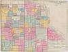
| 33 | RSC-DU-104 | Map | A Map of Dubuque County, with the different School districts colored to distinguish them from each other. Used in Reorganization and Consolidation of Schools in Dubuque County. |
 |
| 34 | RSC-DU-105 | Map | A printed Map of Dubuque County, showing School Districts. Used in Reorganization and Consolidation. |
 |
| 35 | RSC-DU-106 | Map | A printed map of Dubuque County. Official Map of Dubuque County, Iowa. All of the operational rural schools are circled. Used in Reorganization and Consolidation of schools in Dubuque County. |
 |
| 36 | RSC-DU-107 | Map | A map of Dubuque County showing Public and Parochial School attendance 1956-1957. Used in Reorganization & Consolidation of rural schools in Dubuque County. |
 |
| 37 | RSC-DU-108 | Map | A map of Dubuque County showing Public and Parochial School attendance 1956-1957. Used in Reorganization & Consolidation of rural schools in Dubuque County. |
|
| 38 | RSC-DU-109 | Map | A map of Dubuque County. Hand drawn, colored in to show school districts, several from outside Dubuque County are shown. Used in Reorganization & Consolidation of rural schools in Dubuque County. |
 |
| 39 | RSC-DU-110 | Map | A map of Western Dubuque County Community Schools District. Other school districts added in red pen. Used in Reorganization & Consolidation of rural schools in Dubuque County. |
 |
| 40 | RSC-DU-111 | Map | A map of Dubuque County. Hand drawn and colored on the map of are school districts, with school districts outside Dubuque County. Used in Reorganization & Consolidation of rural schools in Dubuque County. |
 |
| 41 | RSC-DU-112 | Map | A map of Dubuque County from 1942. It shows closed and operating rural schools in red ink, with school attendance also listed. |
 |
| 42 | RSC-DU-113 | Map | A map of Dubuque County from 1942. It shows rural school districts colored in on the map, showing Township schools, Rural Independent schools and incorporated Town Schools. |
 |
| 43 | RSC-DU-114 | Map | A map of Dubuque County , shows four school districts throughout Dubuque county. Used In Rural School Reorganization & Consolidation. |
 |
| 44 | RSC-DU-115 | Map | A map of Dubuque County showing the rural school districts colored in. |
 |
| 45 | RSC-DU-116 | Map | A map of Western Dubuque County Community School District with some areas shaded blue. Used in Reorganization & Consolidation |
 |
| 46 | RSC-DU-117 | Map | A map of Western Dubuque County Community School District dated 1962. From Office of the Superintendant of Dubuque County Schools. Used in Reorganization & Consolidation. |
 |
| 47 | RSC-DU-118 | Map | A map of Dubuque County Iowa showing the school Districts. Some of the school names have been underlined in red ink, and the name and part of the outline of the school district of Vernon has been added to the map. Used in reorganization and consolidation of rural schools in Dubuque County. |
 |
| 48 | RSC-DU-74 | Map | General Highway and Transportation Map for Dubuque County, Iowa, dated 1954. Map used in school consolidation and reorganization. |
 |
| 49 | RSC-EM-17 | Map | 1952 map of Emmet County, Iowa. Map has handwritten boundaries for school districts. Used in school district consolidation and reorganization. Originally in Emmet County Box 1 Folder 2 |
 |
| 50 | RSC-EM-18 | Map | General Highway and Transportation Map for Emmet County, Iowa, dated 1948. Handwritten on the map is "A Tenative Plan for School District Reorganization in Emmet County," dated 1958. The map has handwritten boundaries drawn and labelled for some tenative school districts. Originally found in Emmet County Box 1 Folder 2 |
 |