
155-D1-4
Displaying 1 - 41 of 41
| Catalog # | Name | Description | ||
|---|---|---|---|---|
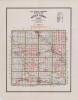
| 1 | RSC-BC-19 | Map | General Highway and Transportation Map of Buchanan County, Iowa, dated 1960. The map includes the locations of individual schools and whether they are in use or not at the time. |
 |
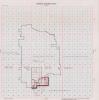
| 2 | RSC-BH-78 | Map | School district plat map of the corrected boundaries in Black Hawk County, Iowa, between the Waverly-Shell Rock Community School District and the Janesville Community School District. Map is dated July 7, 1966. Originally in Butler County Box 5 Folder 17 |
 |
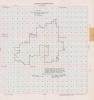
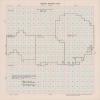
| 3 | RSC-BH-79 | Map | A Map of Black Hawk County from the 1950s used in rural school reorganization & consolidation. |
 |
| 4 | RSC-BT-167 | Map | School district plat map for Allison Community School District, dated July 1, 1956. Shows boundaries of the school district. Originally in Butler County Box 3 Folder 7 |
 |
| 5 | RSC-BT-168 | Map | School district plat map for Allison-Bristow Community School District, dated July 1, 1958. Shows the school district's boundaries, including territory added on July 1, 1957. Originally in Butler County Box 3 Folder 7 |
 |
| 6 | RSC-BT-182 | Map | School district plat map for Clarksville Community School District, dated December 12, 1956. Originally in Butler County Box 3 Folder 26 |
 |
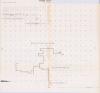
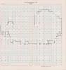
| 7 | RSC-BT-183 | Map | School district plat map for Clarksville Community School District, undated. Rough map in pencil with boundaries outlined and areas labelled. Undated, but in context of original folder the map is from 1956 to 1958. Originally in Butler County Box 3 Folder 27. |
 |
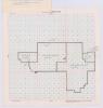
| 8 | RSC-BT-184 | Map | School district plat map for Clarksville Community School District, dated December 12, 1956. The map features handwritten notes about area of territory and monetary amounts. Originally in Butler County Box 3 Folder 27 |
 |
| 9 | RSC-BT-185 | Map | School district plat map for Dumont Community School District, dated October 24, 1956. Includes notes about the area of the territory and monetary value. Originally in Butler County Box 3 Folder 30 |
 |
| 10 | RSC-BT-187 | Map | School district plat map for Greene Community School District, dated September 4, 1957. Originally in Butler County Box 3 Folder 38 |
 |
| 11 | RSC-BT-187 | Map | School district plat map for Greene Community School District, dated September 4, 1957. Originally in Butler County Box 3 Folder 38 |
 |
| 12 | RSC-BT-189 | Map | School district plat map for Parkersburg Community School District, undated. Very similar to July 1, 1955 map of the district, with one difference marked in pencil. Not signed by the county superintendent. Originally in Butler County Box 4 Folder 5 |
 |
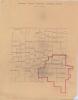
| 13 | RSC-BT-190 | Map | School district plat map for Parkersburg Community School District. Includes names, but not boundaries, of surrounding districts. Undated, but in context of original folder dated 1961. The map includes multiple handwritten inner boundaries at the south end of the Parkersburg district. Originally in Butler County Box 4 Folder 8 |
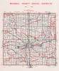
 |
| 14 | RSC-BT-191 | Map | School district plat map for Shell Rock Community School District, dated March 21, 1957. Originally in Butler County Box 5 Folder 2 |
 |
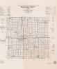
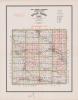
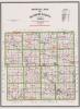
| 15 | RSC-BT-193 | Map | State Highway Commission official map for Butler County, Iowa, dated 1949. Labels school districts and shows their boundaries. Some small handwritten modifications are present, but unlabelled. Originally in Butler County Box 6 Folder 4 |
 |
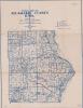
| 16 | RSC-BT-194 | Map | School map of Butler County, Iowa, dated 1938. Prepared by the Iowa State Planning Board and the Iowa Agricultural Experimentation Station. Labels school districts and shows their boundaries. Also indicates where individual schools are and what type of school they are. Originally in Butler County Box 6 Folder 5 |
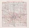
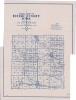 |
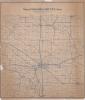
| 17 | RSC-BT-195 | Map | State Highway Commission official map of Butler County, Iowa, undated. Labels school districts and shows their boundaries. Undated, but likely from 1930s-1940s based on original folder and comparison to other maps from time period. Originally in Butler County Box 6 Folder 5 |
 |
| 18 | RSC-BT-196 | Map | School district plat map for the Greene Community School District, dated July 1, 1956. Originally in Butler County Box 6 Folder 5 |
 |
| 19 | RSC-BT-197 | Map | School district plat map, unlabelled. Map is of Greene Community School District, based on comparison of plat outline with RSC-BT-196. Undated, but around 1958 based on small noted transfer of territory. Originally in Butler County Box 6 Folder 5 |
 |
| 20 | RSC-FY-21 | Records | Two Fayette County maps, part of the reorganization and consolidation records. One is dated 1956, the other shows county school districts but is undated. |
 |
| 21 | RSC-FY-32 | Map | Fayette County Plat Map for Oelwein Community School District. Used in rural school consolidation and reorganization. |
 |
| 22 | RSC-FY-33 | Map | Fayette County Plat Map for Oelwein Community School District. Used in rural school consolidation and reorganization. |
 |
| 23 | RSC-FY-34 | Map | Fayette County Plat Map for Oelwein Community School District. Used in rural school consolidation and reorganization. |
 |
| 24 | RSC-FY-35 | Map | Fayette County Map. Amended Fayette County School Plan to Include Hazleton Cons School August 16,1961. |
 |
| 25 | RSC-FY-36 | Map | A Plat Map for Nashua, from A Fayette County Collection of Maps. Used in Reorganization and Consolidation of Rural Schools. |
 |
| 26 | RSC-FY-37 | Map | A Map of Delaware County, from a collection of Fayette County Maps. Used in Rural School Reorganization and Consolidation. |
 |
| 27 | RSC-FY-38 | Map | A Map of Chickasaw County, from a collection of Fayette County Maps. Used in Rural School Reorganization and Consolidation. Hand written "B" on the map. |
|
| 28 | RSC-FY-39 | Map | A Map of Allamake County, from a collection of Fayette County Maps. Used in Rural School Reorganization and Consolidation. Hand written additions in red ink. |
 |
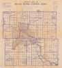
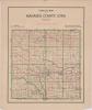
| 29 | RSC-MH-1 | Map | Map of Mahaska County, Iowa from 1939. Scale is 1 mile=3/4 inch. |
 |
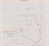
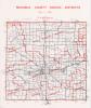
| 30 | RSC-MH-10 | Map | Existing School Districts Mahaska County, Jan. 1, 1956. Handwritten showing all distircts in Mahaska County in 1956, some areas outlined in red ink. |
 |
| 31 | RSC-MH-11 | Map | Existing School Districts Mahaska County, Jan. 1, 1956. |
 |
| 32 | RSC-MH-12A | Map | Existing School Districts Mahaska County, Jan. 1, 1956. Handwritten showing all school districts in Mahaska County, some areas outlined in red ink. |
 |
| 33 | RSC-MH-12B | Map | Existing School Districts Mahaska County, Jan. 1, 1956. Handwritten showing all school districts in Mahaska County, some areas outlined in red ink. |
 |
| 34 | RSC-MH-2 | Map | Mahaska County Schools Districts as of July 1, 1961. Different districts have been marked out with pen, and colored in with color pencil. |
 |
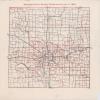
| 35 | RSC-MH-3 | Map | Official Map of Mahaska County, Iowa. Scale-1 Inch, 2 Miles. Copy righted 1936. School Districts shown in red. |
 |
| 36 | RSC-MH-4 | Map | Mahaska County School Districts as of July 1, 1961. School districts outlined in red. |
 |
| 37 | RSC-MH-5 | Map | Mahaska County School Districts as of July 1, 1972. School districts outlined in red. |
 |
| 38 | RSC-MH-6 | Map | Mahaska County School Districts as of July 1, 1965. School districts outlined in red. |
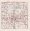 |
| 39 | RSC-MH-7 | Map | Mahaska County School Districts as of July 1, 1965. School districts outlined in red. |
 |
| 40 | RSC-MH-8 | Map | Map of Existing School Districts Mahaska County, Jan. 1, 1956. Hand-drawn showing all school districts in Mahaska County. |
 |
| 41 | RSC-MH-9 | Map | Mahaska County School Districts as of April 1, 1965. School districts outlined in red. |
 |