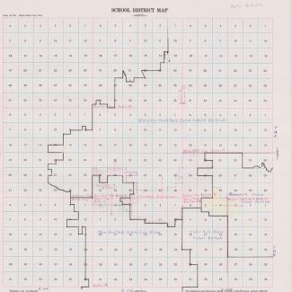
School district plat map for an area of northeastern Iowa, focused on the towns of Shell Rock and Waverly. Undated, but likely from 1957 based on original folder. The map shows a "Waverly-Shell Rock Community School District" and nearby districts. Several small districts have arrows that go from their area to a larger nearby area.
Originally in Butler County Box 5 Folder 3
Purchase:
Gift:
Found in Collection:
Institution:
Institution

