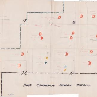
Hand-drawn map of an 8 square mile area in northern Iowa between Dike, Wellsburg, and Parkersburg. Undated, but from 1961 based on the original folder it was in. The map lists adult residents, the number of children, and whether they want to join Parkersburg Community School District, Dike Community School District, or if they are undecided. The map also lists some statistics about information like the number of tenents in the area or how many objectors to the consolidation plan there are. Some of these residents were previously in Beaver Township No. 3, Beaver Township No. 4, and Beaver Township No. 5 of Grundy County.
Originally in Butler County Box 4 Folder 9
Purchase:
Gift:
Found in Collection:
Institution:
Institution

